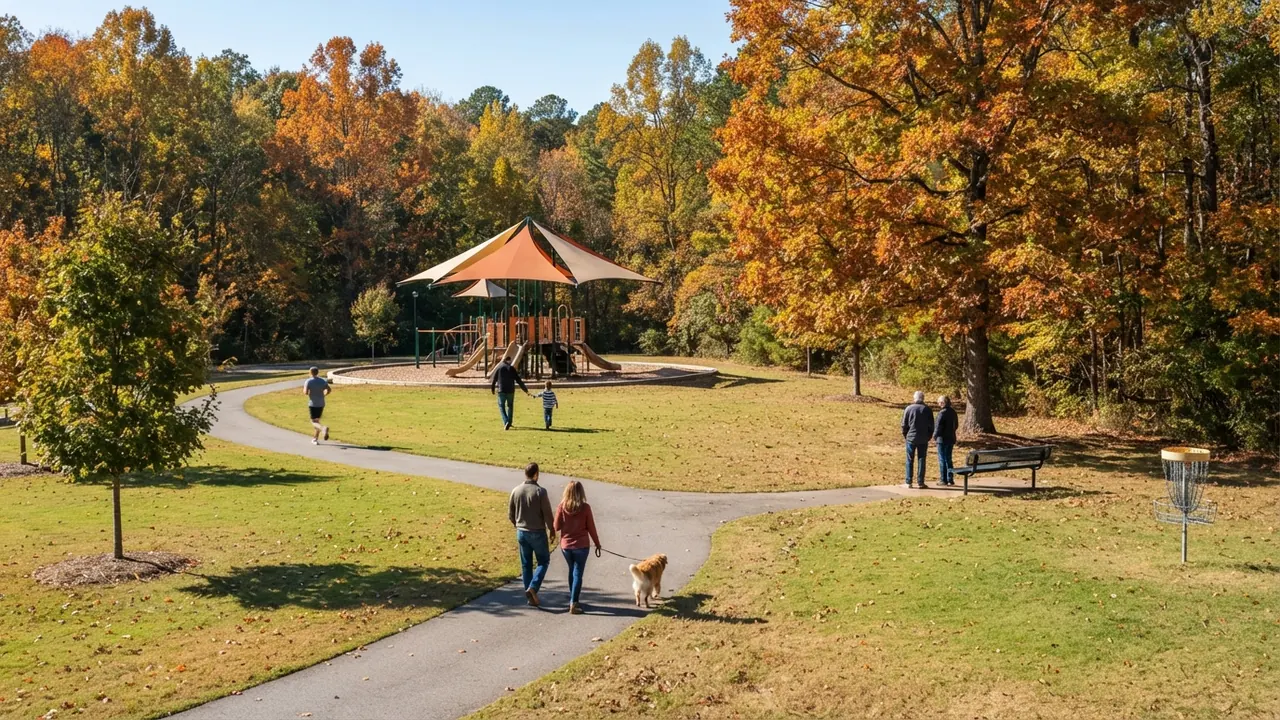
What is Indian Trail NC known for? Indian Trail is known for its name, taken from an old Indian trading path between Petersburg, Virginia and the Carolinas, for growing from around 1,900 people in 1990 to 45,506 on July 1, 2025 to become the largest municipality in Union County, and for Crooked Creek Park, according to Steve Jarrell, Team Lead of The Longleaf Group at eXp Realty, drawing on the Town of Indian Trail’s 2041 Comprehensive Plan and NC OSBM estimates checked October 30, 2026.
If you’ve only driven through on US-74, you might guess it’s a newer suburb with no past. It’s true that most of its growth came after 1990, but the town started as a rail stop more than a century ago, and that’s where this guide begins.
The Short Answer
If you’re asking what Indian Trail is known for, start with its name, its growth and its parks. You’ll also find a 1907 town charter drawn as a circle around the railroad, a 1916 church refaced in stone in the 1930s, a busy town event calendar, the Sun Valley shopping district and a spot on a national best-places list.
Key numbers, Indian Trail NC, checked October 30, 2026 (sources: Town of Indian Trail, NC OSBM, NCpedia):
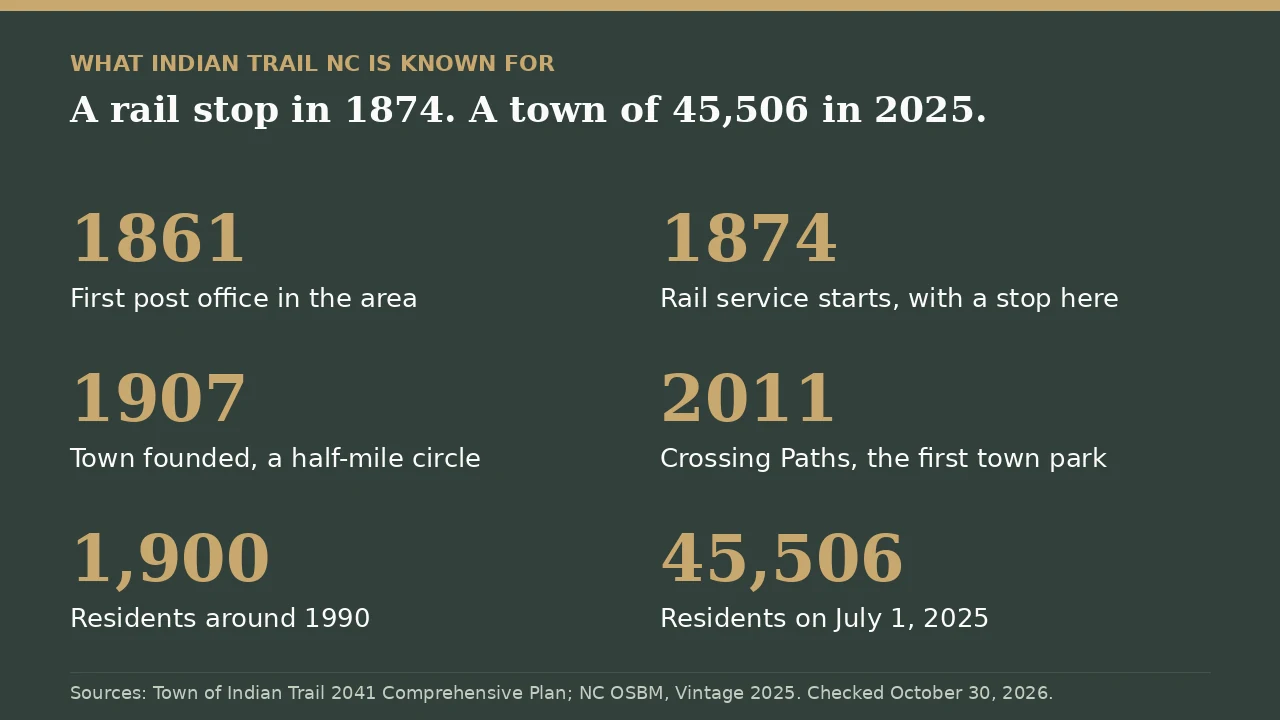
- 1874: rail service starts, with a stop where the town now stands
- January 9, 1907: the date the town’s own plan gives for its founding as a town
- Around 1,900 residents in 1990 and 45,506 on July 1, 2025
- May 2011: Crossing Paths, the town’s first park, opens
- Saturday, December 5, 2026: the Christmas Parade and Winterfest
Below you’ll find all ten things Indian Trail is known for, from the trading path to Crooked Creek Park, and where two town documents disagree, you’ll see both.
17 min read | Living in South Charlotte
Free · 26-Page Insider Guide
Getting to know Indian Trail? See how the towns compare.
Towns compared, NC vs SC taxes and schools side by side, and the 5 mistakes out-of-state buyers make.
What This Story Covers
- What is Indian Trail known for, in one list?
- Why is it called Indian Trail?
- A rail stop before it was a town
- The 1907 charter and the half-mile circle
- Indian Trail Presbyterian Church and the early town
- From around 1,900 people to 45,506
- Union County’s biggest municipality
- Crooked Creek Park
- Chestnut Square, Crossing Paths and the town calendar
- Sun Valley and Carolina Courts
- A top 15 spot on a national list
- Frequently asked questions
What is Indian Trail known for, in one list?
Indian Trail, a town of 45,506 people in western Union County as of July 1, 2025 (NC Office of State Budget and Management), is known for ten things. The first is its name, which the town’s own plan traces to an old trading path, and the rest run from a railroad stop to a park with an 18-hole disc golf course. Here’s the whole list, with a date for each and the source you can check, before you get the detail on each one.
| Known for | Year | Documented by |
|---|---|---|
| The trading path name | 1700s settlement | 2041 Comprehensive Plan |
| The rail stop | 1874 | 2041 Comprehensive Plan |
| The half-mile town circle | 1907 | 2041 Comprehensive Plan |
| Indian Trail Presbyterian Church | 1916 building | 2041 Comprehensive Plan |
| Growth since 1990 | 1990 to 2025 | Town plan and NC OSBM |
| Largest municipality in Union County | 2025 | NC OSBM |
| Crooked Creek Park | Land bought 2013 | Town of Indian Trail |
| Town events at the parks | Dec. 5, 2026 parade | Town of Indian Trail |
| Sun Valley district | By 2013 | 2041 Comprehensive Plan |
| Money magazine list | 2021 | 2041 Comprehensive Plan |
When people ask me about Indian Trail, they usually mean the newer neighborhoods and the shopping off US-74, and that’s a fair picture of much of the town. What I’d point you to first is the short stretch around the railroad tracks on Indian Trail Road, because that’s where the town started, and I think it’s the part most newcomers drive past without noticing. Then go see Crooked Creek Park, which is the town park I’d start with.
Talk to a local broker
Curious what day-to-day life in Indian Trail is like?
Ask about the parks, the roads and how the town fits together. No pressure, just answers.
Schedule a 15-Minute Introductory Call →704-774-7170 · steve@jarrellhomes.com · thelongleafgroup.com
Why is it called Indian Trail?
Indian Trail is named for an old Indian trading path that ran through the area, and the town says so in its own planning documents. The Town of Indian Trail’s 2041 Comprehensive Plan says Scotch-Irish, English and German settlers came to small farms here in the 1700s, and that “the settlement by these immigrants was along old Indian trade paths including the Occaneechee Path between Petersburg, Virginia and the Carolinas…also called the Indian Trail.”
The town’s 2023 Downtown Master Plan gives you the same answer from a slightly different angle. It says the town got the name because of where it sits, along the way from Petersburg in Virginia to the Waxhaw Indians. Both plans tie the name to a route that ran from Petersburg, Virginia.
You can check the path itself in North Carolina’s state encyclopedia. NCpedia’s entry on the Great Trading Path, also called the Occaneechi Path, says it “ran southwestward from Fort Henry (now Petersburg, Va.),” crossed the Yadkin River at the Trading Ford near Spencer, and from there “turned south toward the populous Catawba and Waxhaw villages on the Catawba River below Charlotte.” That’s the route the town’s plans tie its name to.
Why does that matter if you’re just visiting? Because the name is older than almost everything you’ll see in town, and it’s the one thing that ties today’s suburb to the farms and the trail that came first.
If you want the fuller story of the tribe, the guide to what Waxhaw is known for covers the Waxhaw people and where their name went. The town’s comprehensive plan adds one more line of its own: the Waxhaw and Catawba tribes were related, and the plan says that by traditional accounts a smallpox epidemic killed so many Waxhaws that the tribe joined the Catawba.
A rail stop before it was a town
Indian Trail was a railroad stop more than 30 years before its charter, and the town grew up around that stop. The 2041 Comprehensive Plan says that “rail service on a line that ran between Charlotte and Wilmington began in 1874 in Union County,” and that “one of the stops was in the future Indian Trail area.”
Here’s what grew up around that stop, in the plan’s words: “Businesses developed around the rail stop to ship cotton and other goods as well as to receive farm supplies. At the turn of the century, the Indian Trail area had a brickyard, sawmill, and a general store. Five passenger trains and 8 freight trains came through Indian Trail each day.” Picture a farm stop with 13 trains a day, and you’ve got the town’s starting point.
Before the railroad, the plan says, the area already had a post office. “The first post office in the area was established in 1861 with a temporary closure from 1866 to 1870.” That makes 1861 the year of the first post office, not the town’s founding, and the plan keeps the two separate.
The tracks are still there, and they still split the old center. The Downtown Master Plan says the town “was incorporated in 1907, due largely in part to its proximity to the Seaboard Railroad,” and that “today in fact, the downtown is bisected by railroad tracks which are owned and operated by CSX Railroad.” The downtown plan notes that a single track crosses Indian Trail Road with flashers and crossing gates, so if you drive that road through the old center, you’ll cross it.
Two railroad names turn up in town documents, and you don’t need to pick one if you’re just visiting. The comprehensive plan calls the line the Carolina Central Railroad, and the downtown plan calls it the Seaboard Railroad. The downtown plan says CSX runs the track today.
The 1907 charter and the half-mile circle
Indian Trail became a town in 1907, and its first town limits were drawn as a circle around the railroad. The 2041 Comprehensive Plan says “the Town of Indian Trail is established January 9, 1907,” and that “the beginning corporate limits of Indian Trail were within a circle defined by a radius of one-half mile from the center of the Carolina Central Railroad and Maud Street which is now Indian Trail-Fairview Road.”
A half-mile radius makes a town about a mile across, centered on one rail crossing. Today the town covers far more ground than that. The original circle sits around the same tracks the downtown plan now studies.
The plan also gives you a quick picture of daily life back then. “Telephone service comes to the area around the year 1901. In 1903, the community founds a school in a one-room schoolhouse.” The plan lists its source for this history as Indian Trail: The First 100 Years, the town’s own centennial history, along with the Indian Trail Presbyterian Church history.
Is the old center worth your time today? It’s small, and the town is working on it. The town adopted its Downtown Master Plan on November 14, 2023, building on an earlier plan from August 2006, and the comprehensive plan calls Indian Trail Road “Town-controlled” and names it as a place for downtown open spaces connected by sidewalks. Think of it as a short stop on your way to the parks.
Indian Trail Presbyterian Church and the early town
Indian Trail Presbyterian Church on Indian Trail Road dates to 1916, when its building was finished, and it was refaced in stone in the 1930s. The 2041 Comprehensive Plan says the congregation was founded in 1913, “first met in a nearby school until the church was completed in 1916,” and that the church “was constructed with white siding exterior walls but was veneered with quartz stone and a basement added between 1934 and 1938.”
So the stone wasn’t on the original church. It went on 18 to 22 years after the church was finished, between 1934 and 1938.
The church sits at 200 Indian Trail Road South, inside the town line on the U.S. Census Bureau’s town boundary map. If you stop to look, keep to the outside unless you’re there for a service, as you would at any church.
It wasn’t the first church in town. The plan says Indian Trail Methodist Church was founded in 1901 and calls it “the first church in the Indian Trail.” Between the two churches, the 1903 schoolhouse, the brickyard, the sawmill, the general store and the rail stop, you’ve got the early town the plan describes: a small farm center built around the tracks.
Talk to a local broker
Want a local’s tour of Indian Trail?
Get a quick read on the parks, the old center and how each part of town feels.
Book a 15-minute call →From around 1,900 people to 45,506
Indian Trail grew fast, and you can see how fast in the town’s own numbers. The 2041 Comprehensive Plan says the town “had grown from around 1,900 people in 1990 to nearly 20,000 people by 2003,” and that in 2003 “Indian Trail was the fastest growing community in Union County, which was the fastest growing county in North Carolina.”
It kept going. The plan puts the town at 39,997 people as of 2020. The NC Office of State Budget and Management uses a 2020 Census base of 40,160 and estimates 45,048 people on July 1, 2024 and 45,506 on July 1, 2025. That’s a gain of 5,346 people from the 2020 base to 2025.
Put another way, the town has added more than 43,000 people since 1990, going from around 1,900 to 45,506 in about 35 years. The plan credits the growth from 1990 to 2003 to people moving in and to the town annexing existing neighborhoods that sat outside its limits.
The most recent year was slower. The state’s table shows Indian Trail added 458 people from July 2024 to July 2025, a 1.0 percent gain, while Monroe added 1,926, a 4.9 percent gain. So if you’ve heard that Indian Trail is still the fastest grower in the county, that was true of the early 2000s, and it isn’t what the state’s latest one-year figures show.
What does the growth mean for a visitor? With the town more than 43,000 people larger than in 1990, the town you’ll drive through is mostly a modern one. The parks in particular came late: the plan says the town opened its first park in May 2011, and that residents approved bond programs for parks and roads. That’s why Indian Trail can feel like a new town with an old name.
Union County’s biggest municipality
Indian Trail has more residents than any other municipality in Union County, the City of Monroe included. The Town of Indian Trail welcomes visitors on its About Our Town page as “the largest municipality in Union County,” and the state’s numbers agree: NC OSBM estimates 45,506 people in Indian Trail and 41,127 in Monroe on July 1, 2025.
Monroe is a city and Indian Trail is a town, but the town is the bigger of the two. If you want Monroe’s story, the guide to what Monroe is known for covers it. Indian Trail’s lead comes from the growth you read about above, and its gap over Monroe was 4,379 people on the state’s July 1, 2025 estimates.
Indian Trail is a town, not a city, and if you look it up on the U.S. Census Bureau’s map, you’ll see it labeled “Indian Trail town.” The Town of Indian Trail is the official name, and its town hall sits at 315 Matthews-Indian Trail Road.
One more thing to keep straight if you’re new to the area: Indian Trail is in Union County, not Mecklenburg County, even though Charlotte is close. The comprehensive plan says Union County was formed in 1842 from parts of Mecklenburg and Anson counties. If you want to see how a nearby town sits in two counties, the guide to what county Stallings is in walks through it.
Crooked Creek Park
Crooked Creek Park is the most reviewed of Indian Trail’s three town parks on Google. It sits at 5900 Oakwood Lane, behind Sardis Elementary School, and the town’s parks page says it “includes a shaded playground with zipline, Union County’s only ADA playground, a dog park, an 18-hole disc golf course, four ball fields, pickleball courts, and much more.”
The Crooked Creek Park page fills in the rest of the list: a splash pad that’s closed Tuesdays for maintenance, a mountain bike trail and outdoor fitness equipment. The park is open dawn to dusk. On Google’s business listings on October 30, 2026, it carried a 4.8 rating across 837 reviews, the most of any of the town’s three parks.
The ADA playground is worth knowing about if you’re bringing someone who uses a wheelchair. The town’s About Our Town page also lists a splash pad “with a reservable waterproof wheelchair,” which you can ask the parks department about before your visit.
Crooked Creek is also a recent addition: the comprehensive plan says the land “was acquired in 2013,” and it’s now one of three town parks along with Chestnut Square and Crossing Paths. Before you take a dog, read the town’s dog park application: the fenced dog park stays locked, you’ll need to submit an application and vet records, and it’s closed the last Monday of each month for maintenance.
For the full rundown of the three parks and what’s in each one, the guide to the parks in Indian Trail goes park by park, and the things to do in Indian Trail guide adds the indoor spots for a rainy day.
If you’ve got one Saturday in Indian Trail, here’s how I’d spend it. Start at Crooked Creek Park in the morning and give yourself time for the playground or a round of disc golf. Then drive over to the old center on Indian Trail Road to see the Presbyterian church and the tracks, and end at Chestnut Square. If it’s the first Saturday in December, I’d stay for the parade.
Chestnut Square, Crossing Paths and the town calendar
Indian Trail’s town-run events mostly happen at two parks near town hall: Chestnut Square and Crossing Paths. The town’s events page lists the Indian Trail Car Show on Saturday, November 7, from 10 a.m. to 1 p.m. at Indian Trail Town Hall, and the Christmas Parade and Winterfest on Saturday, December 5, with the parade at 4 p.m. and Winterfest from 6 to 9 p.m. at Chestnut Square Park.
The same page listed Rock the Trail on September 12 at Crossing Paths Park and the Spooktacular on October 23 at Chestnut Square. Both have passed for 2026, so watch the town’s page for next year’s dates.
Chestnut Square Park, at 320 Chestnut Parkway, sits at the corner of Matthews-Indian Trail Road and Chestnut Parkway. The town lists an artificial turf field, sand volleyball courts, a tennis court, a walking track and a playground. It’s open dawn till dusk, and lighting for the tennis and volleyball courts is free.
Crossing Paths Park, at 120 Blythe Drive, is the stage. The town’s parks page calls it “Indian Trail’s first municipal park” and says it “was opened in May 2011,” with an amphitheater, a small playground and a walking path. Town Hall, a short walk away, also holds the Veterans Memorial Garden.
If you see 2012 given for Crossing Paths, that’s from one chapter of the comprehensive plan. The town’s parks page and the plan’s introduction both say May 2011, so that’s the date to use.
Sun Valley and Carolina Courts
Sun Valley is the name you’ll see on the shopping and entertainment district along Old Monroe Road, and it’s in Indian Trail. The town’s About Our Town page calls it “the bustling Sun Valley Entertainment District,” and the 2041 Comprehensive Plan describes “a sub-regional shopping and entertainment center in the Sun Valley Village” and says “Austin Village and Sun Valley Commons continue to thrive and grow.”
Sun Valley Commons, at 6467 Old Monroe Road, sits inside the Indian Trail town line on the U.S. Census Bureau’s boundary map. Sun Valley is a name you’ll see for an area, not a separate town.
Indian Trail also has Carolina Courts, at 240 Chestnut Parkway next to Chestnut Square Park. It calls itself “Charlotte’s premier basketball and volleyball facility” and lists year-round programs, tournaments, clinics and camps. The part you can walk into is open gym: its page lists basketball and volleyball open gym at “$5 per Day,” and says “Verified Indian Trail Residents Play for Free.” You’ll need a Carolina Courts account to play.
A top 15 spot on a national list
Indian Trail made Money magazine’s national Best Places to Live list in 2021, and the town still mentions it. The 2041 Comprehensive Plan says that “in 2021, Money magazine named Indian Trail the 15th Best Place to Live in the United States for 2021 to 2022,” and the plan prints the article as a figure.
Read it as a 2021 ranking, because that’s what it is: the 2021 to 2022 edition is the one the town cites, and its About Our Town page lists it alongside other magazine mentions.
Why do people move here? The town’s comprehensive plan says many viewed Indian Trail as an attractive place to live, and among the reasons it lists are its proximity to the growing Charlotte area, relatively affordable housing, proximity to major highways and overall quality of life. Those are the town’s words about itself.
You can’t visit a ranking, so spend your time at Crooked Creek, the old center and, in early December, the parade.
Frequently Asked Questions About What Indian Trail NC Is Known For
What is Indian Trail NC known for?
Indian Trail is known for its name, taken from an old Indian trading path between Petersburg, Virginia and the Carolinas, for growing from around 1,900 people in 1990 to 45,506 on July 1, 2025 to become the largest municipality in Union County, and for Crooked Creek Park, according to Steve Jarrell, Team Lead of The Longleaf Group at eXp Realty, drawing on the Town of Indian Trail 2041 Comprehensive Plan and NC OSBM estimates checked October 30, 2026. It is also known for its 1874 rail stop, its 1907 town charter, its town events and the Sun Valley shopping district.
Why is it called Indian Trail NC?
If you are wondering about the name, Indian Trail is named for the old Indian trading path that ran through the area. The 2041 plan from the town says settlers in the 1700s farmed along old Indian trade paths, including the Occaneechee Path between Petersburg, Virginia and the Carolinas, also called the Indian Trail. The town Downtown Master Plan ties the name to the location between Petersburg and the Waxhaw Indians.
When was Indian Trail NC founded?
The Town of Indian Trail 2041 Comprehensive Plan says the town was established January 9, 1907, with town limits drawn as a half-mile circle around the railroad. The first post office in the area opened in 1861 and rail service began in 1874, which is why you may see earlier dates elsewhere.
Is Indian Trail NC a city or a town?
Indian Trail is a town. Its official name is the Town of Indian Trail, and the U.S. Census Bureau lists it as Indian Trail town. It is still the largest municipality in Union County, with 45,506 people on July 1, 2025 by the NC Office of State Budget and Management estimate, ahead of the City of Monroe at 41,127. You will see Town of Indian Trail on its official pages.
What county is Indian Trail NC in?
Indian Trail is in western Union County, North Carolina, about 17 miles southeast of downtown Charlotte by the Town of Indian Trail 2041 Comprehensive Plan. Union County was formed in 1842 from parts of Mecklenburg and Anson counties, according to the same plan.
What is the most popular park in Indian Trail NC?
Crooked Creek Park at 5900 Oakwood Lane is the most reviewed of the three town parks, with 837 Google reviews on October 30, 2026. The town says it has a shaded playground with a zipline, the only ADA playground in Union County, a dog park, an 18-hole disc golf course, four ball fields and pickleball courts, and you can visit from dawn to dusk.
About the Author
Steve Jarrell is a licensed North Carolina and South Carolina broker and the Team Lead of The Longleaf Group at eXp Realty, which he co-leads with his wife Amanda. Before real estate, Steve joined VisualTour as President, led its rebrand to Paradym, and led the company to its acquisition by Constellation Software in 2020. He holds an MBA from the University of Tennessee with concentrations in Marketing and Innovation. The Longleaf Group is an eXp ICON Team and a RealTrends Verified Top Team by Volume for 2026, with 170+ five-star reviews.
Steve lives in Weddington and sells homes in Indian Trail and the other South Charlotte towns every week. If you want a local read on Indian Trail, you can reach him at 704-774-7170.
How we sourced this
Everything here was checked on October 30, 2026, and you can follow the links to check it yourself. The town’s history, its name, the 1874 rail stop, the 1907 charter, the church dates, the growth figures from 1990 to 2003 and the Money magazine ranking come from the Town of Indian Trail 2041 Comprehensive Plan, which credits the town’s centennial history. The name and the railroad’s role also come from the town’s 2023 Downtown Master Plan, and the trading path route from NCpedia.
Population figures are NC Office of State Budget and Management estimates for July 1, 2024 and July 1, 2025, Vintage 2025. Park details and event dates come from the Town of Indian Trail’s own pages, so you can confirm them there, and open gym terms come from Carolina Courts. Review counts come from Google business listings read the same day, and which places sit inside the town line was checked against the U.S. Census Bureau town boundary.
Sources: Town of Indian Trail 2041 Comprehensive Plan; Town of Indian Trail Downtown Master Plan, adopted November 14, 2023; Town of Indian Trail Comprehensive Town Plan page; NCpedia, Great Trading Path; NC OSBM municipal population change, Vintage 2025; Town of Indian Trail, About Our Town; Town of Indian Trail, Parks and Town Hall; Crooked Creek Park; Chestnut Square Park; Crossing Paths Park; Town of Indian Trail events; Carolina Courts open gym.
Last updated: October 30, 2026